Browse Collection › Maps › Durham, North Carolina / Department of Public Works/ 1951
|
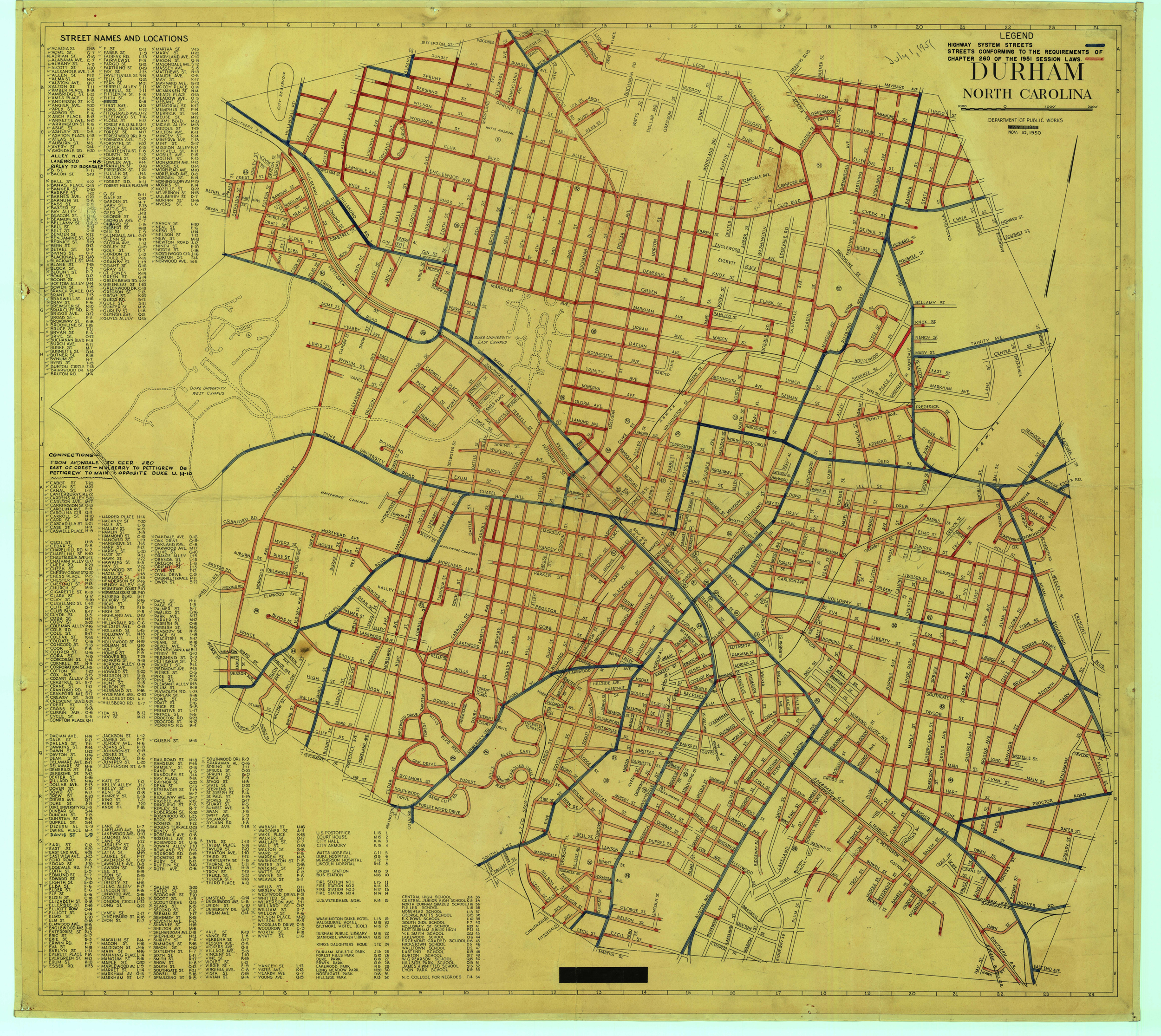
Page 1/1 Durham, North Carolina / Department of Public Works/ 1951 Creator(s): Durham, (N.C.). Department of Public Works, Publisher Date: 1951 Description: This map of Durham, North Carolina, created by the Department of Public Works, appears to have been modified between its initial publication in 1948 and 1951. The legend indicates that color annotations were introduced in 1951 which help the user distinguish between “highway system streets” (marked in black) and “streets conforming to the requirements of chapter 260 of the 1951 Session Laws (marked in red). There are three dates on this map: May 1948 which is crossed out, November 10, 1950, and July 1951. The map provides street names as well as an index to streets within the city of Durham, North Carolina a list of schools with identifying markers and other sites including parks, hotels, fire houses, government buildings and libraries. Source: Durham, (N.C.). Department of Public Works. Library of Congress Subject Headings: Durham (N.C.) -- Maps -- 20th century Durham (N.C.) -- History Streets -- North Carolina -- Durham Geographic Term: Durham (N.C.) |

digitaldurham@duke.edu · About this site · Copyright © 2001 - 2006. Trudi J. Abel. All Rights Reserved.
The copyright interest in the material in this digital collection has not been transferred to the Digital Durham project. These text and images may not be used for any commercial purpose without the permission of the David M. Rubenstein Rare Book & Manuscript Library and the Digital Durham Project. Copyright permission for subsequent uses is the responsibility of the user.