Browse Collection › Maps › "This Map of Durham as I remember in 1867-1868. Drawn from memory entirely and no attempt made at correct angles or measurements."
|
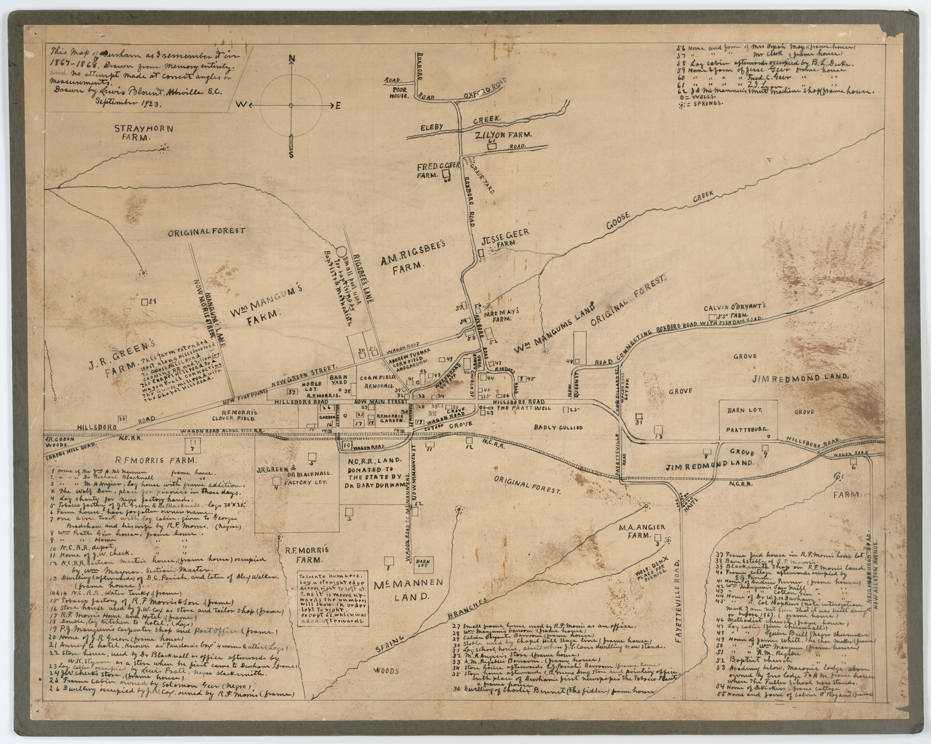
Page 1/1 "This Map of Durham as I remember in 1867-1868. Drawn from memory entirely and no attempt made at correct angles or measurements." Creator(s): Blount, Lewis, Author Date: 1867 ( Drawn in 1923 ) Description: Lewis Blount of Abbeville, South Carolina penned this map in 1923. He called it, "This Map of Durham as I remember in 1867-1868. Drawn from memory entirely and no attempt made at correct angles or measurements." He delineates some of the natural features--creeks and springs--major roads, the North Carolina railroad line running through town, of what is now downtown Durham and southwest Durham. He also provides an index to some sixty sites including graveyards, homesteads, churches, black- and white-owned businesses and factories. Source: Southern United States manuscript map collection, 1850-1923, nd., David M. Rubenstein Rare Book & Manuscript Library, Duke University, Durham, North Carolina. Dimensions: 58 x 73 cm. Library of Congress Subject Headings: Durham (N.C.) -- Maps -- 19th century North Carolina--Maps, Manuscript Real property -- North Carolina -- Durham -- Maps Geographic Term: Durham (N.C.) |
digitaldurham@duke.edu · About this site · Copyright © 2001 - 2006. Trudi J. Abel. All Rights Reserved.
The copyright interest in the material in this digital collection has not been transferred to the Digital Durham project. These text and images may not be used for any commercial purpose without the permission of the David M. Rubenstein Rare Book & Manuscript Library and the Digital Durham Project. Copyright permission for subsequent uses is the responsibility of the user.