Browse Collection › Maps › Trinity College/Durham, N.C.
|
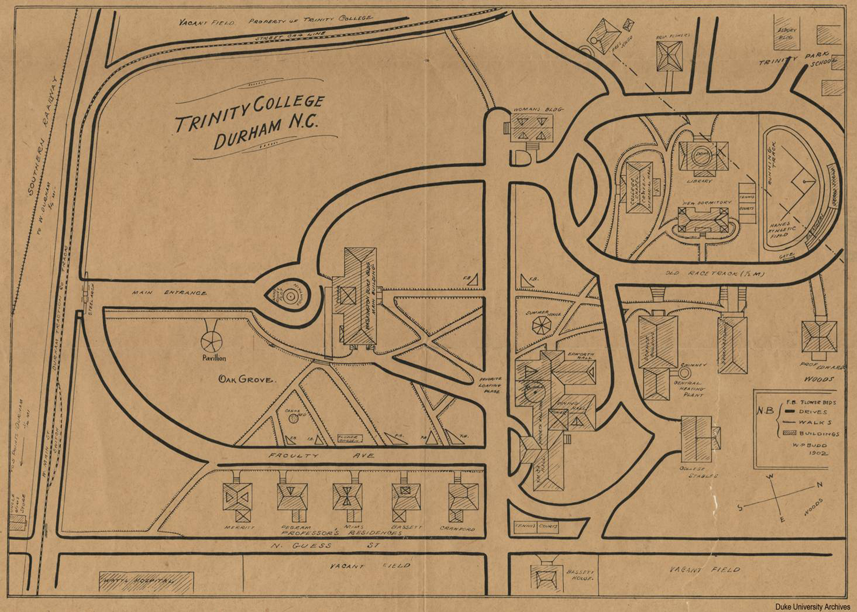
Page 1/1 Trinity College/Durham, N.C. Creator(s): Budd, W. P., Author Date: 1902 Description: W.P. Budd's map of the Trinity College, Durham, North Carolina identifies key structures and indicates where they stood on campus in 1902. The map includes the location of the chapel, library, dormitories, recreational areas, and stables as well as the homes of professors John Spender Bassett, William I. Cranford, Edwin Mims, William H. Pegram, A. H. Merritt, M. J. Edwards, Robert L. Flowers, and President John C. Kilgo. Additionally, the map shows the location of Watts Hospital and Trinity Park School as well as railroad and streetcar lines. Some of the homes illustrated on this map were later moved to the eastern side of Buchanan Avenue, in the Trinity Park neighborhood. Source: Duke University Archives Library of Congress Subject Headings: Trinity College (Durham, N.C.) Watts Hospital (Durham, N.C.) -- History. Trinity College (Durham, N.C.) -- Buildings Trinity College (Durham, N.C.) -- History -- 20th century Durham (N.C.) -- Maps -- 20th century Durham (N.C.) -- History Real property -- North Carolina -- Durham -- Maps Geographic Term: Durham (N.C.) Trinity Park (Durham, N.C.) |
digitaldurham@duke.edu · About this site · Copyright © 2001 - 2006. Trudi J. Abel. All Rights Reserved.
The copyright interest in the material in this digital collection has not been transferred to the Digital Durham project. These text and images may not be used for any commercial purpose without the permission of the David M. Rubenstein Rare Book & Manuscript Library and the Digital Durham Project. Copyright permission for subsequent uses is the responsibility of the user.