Browse Collection › Maps › Plan of the Town of Durham Showing Pipe Distribution of the Durham Water Company
|
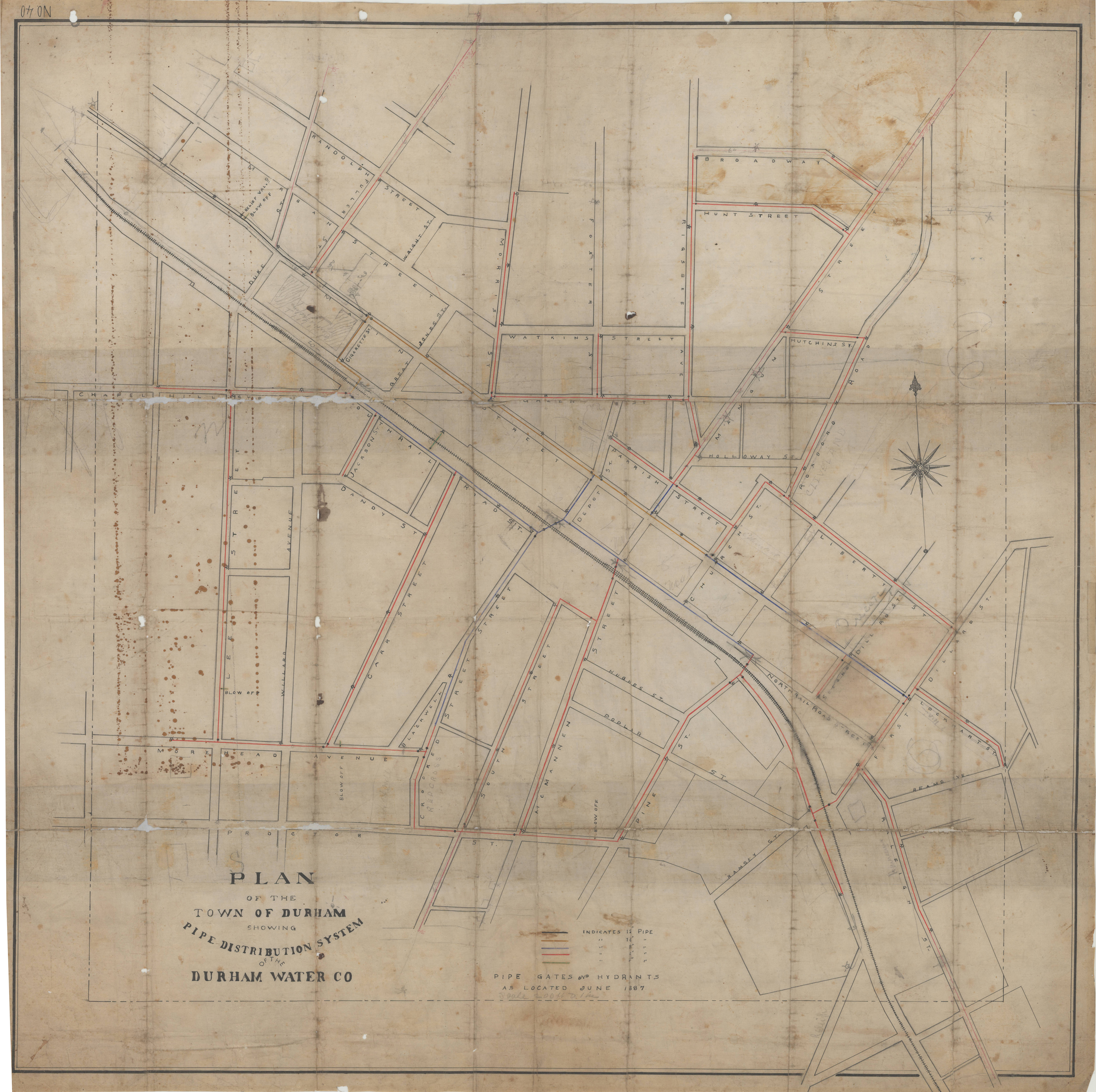
Page 1/1 Plan of the Town of Durham Showing Pipe Distribution of the Durham Water Company Date: 1887 Description: This map provides details of street names within the town of Durham and indicates the diameter of water pipes and location of hydrants as of 1887. Scale: 200 feet per inch or [1:2,400]. Source: Durham (N.C.). Dept. of Public Works. Library of Congress Subject Headings: Durham (N.C.) -- Maps -- 19th century Streets -- North Carolina -- Durham Durham (N.C.) -- History Geographic Term: Durham (N.C.) |
digitaldurham@duke.edu · About this site · Copyright © 2001 - 2006. Trudi J. Abel. All Rights Reserved.
The copyright interest in the material in this digital collection has not been transferred to the Digital Durham project. These text and images may not be used for any commercial purpose without the permission of the David M. Rubenstein Rare Book & Manuscript Library and the Digital Durham Project. Copyright permission for subsequent uses is the responsibility of the user.