Browse Collection › Maps › Map of the town of North Durham: property of B. L. Duke and its relative position to Durham, North Carolina
|
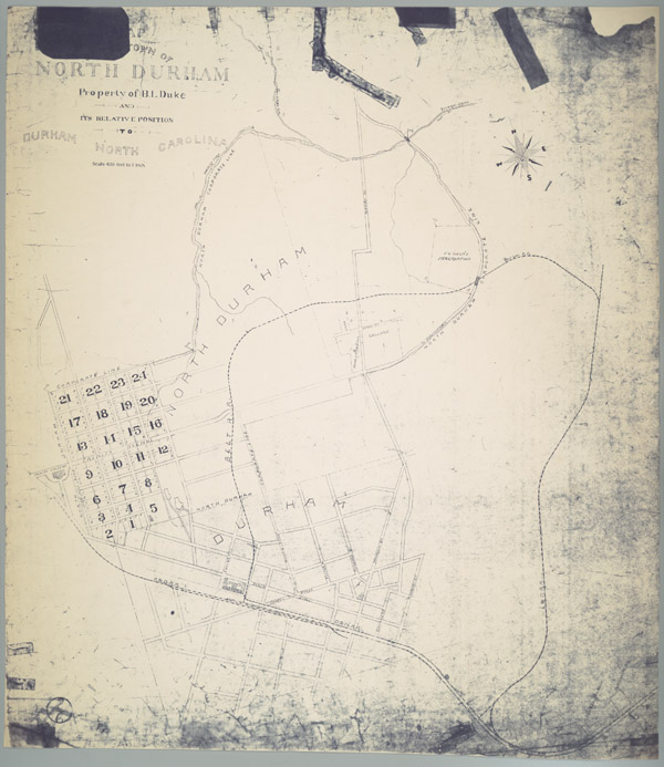
Page 1/1 Map of the town of North Durham: property of B. L. Duke and its relative position to Durham, North Carolina Date: 1890 Description: An 1890 map showing the property owned by Brodie Leonidas Duke in Durham, North Carolina, just east of Trinity College, in an area now identified as Trinity Park. The map also provides names of downtown streets, shows the location of Bobbin & Shuttle Mills, fertilizer factory, cotton factory and railroad lines. Scale 400 feet to 1 inch or [ca.1:4800]. Source: Map of the town of North Durham: Property of B. L. Duke and its relative position to Durham, North Carolina, David M. Rubenstein Rare Book & Manuscript Library, Duke University, Durham, North Carolina. Dimensions: 84 x 73 cm Library of Congress Subject Headings: Real property -- North Carolina -- Durham -- Maps Land tenure -- North Carolina -- Durham County Trinity College (Durham, N.C.) Durham (N.C.) -- History Historic buildings -- North Carolina -- Durham Duke family Duke, Brodie Leonidas, 1846-1919 Business enterprises -- North Carolina -- Durham Real estate development -- North Carolina -- Durham County Durham (N.C.) -- Maps -- 19th century Textile industry -- North Carolina -- Durham -- 19th century Durham Bobbin and Shuttle Mill Company Geographic Term: Trinity Park (Durham, N.C.) Durham (N.C.) |
digitaldurham@duke.edu · About this site · Copyright © 2001 - 2006. Trudi J. Abel. All Rights Reserved.
The copyright interest in the material in this digital collection has not been transferred to the Digital Durham project. These text and images may not be used for any commercial purpose without the permission of the David M. Rubenstein Rare Book & Manuscript Library and the Digital Durham Project. Copyright permission for subsequent uses is the responsibility of the user.


