Browse Collection › Maps › Sanborn Fire Insurance Map, Durham, North Carolina, 1888
Go to Page:
of 7
|
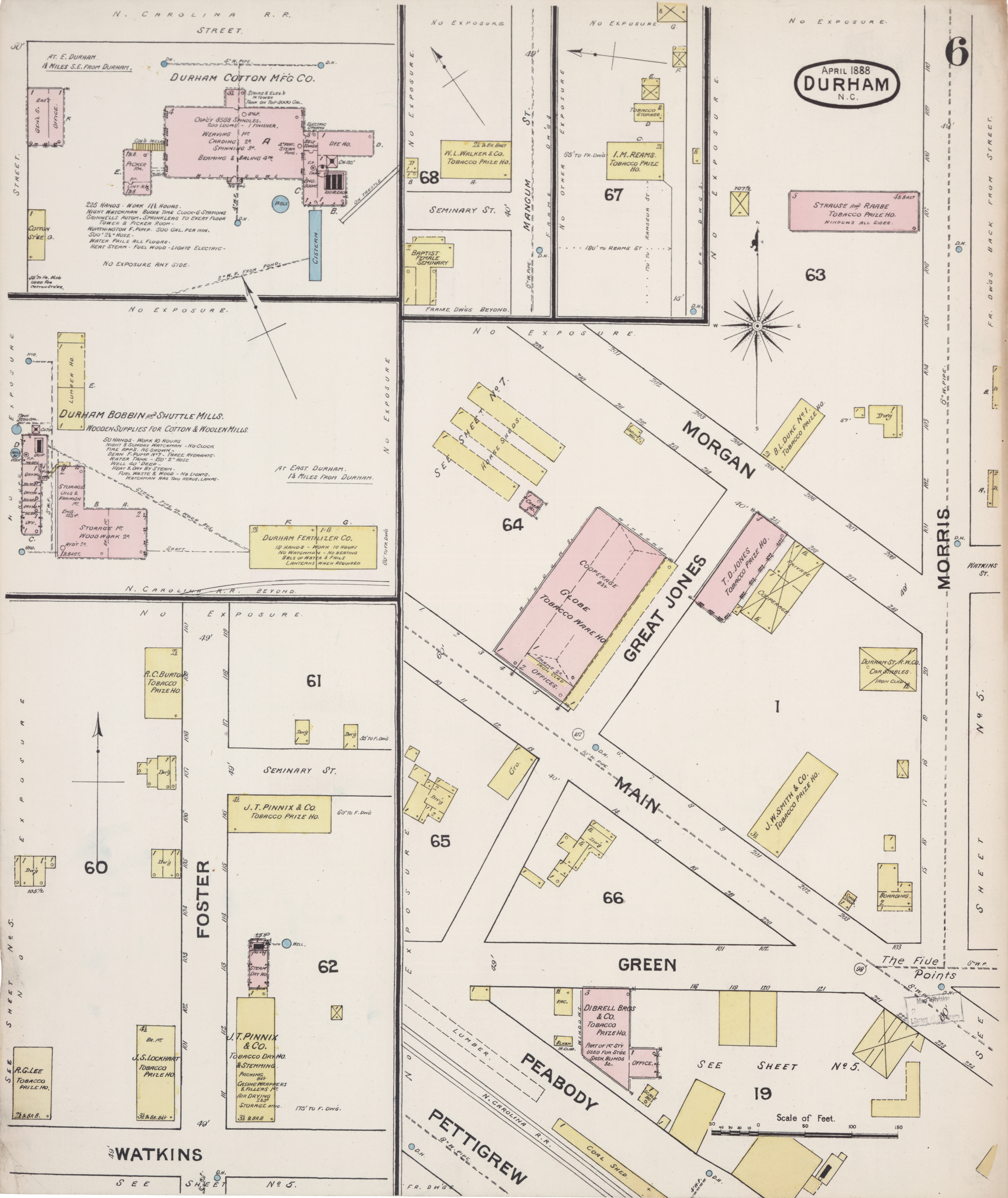
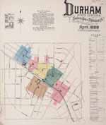
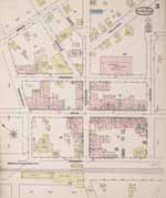
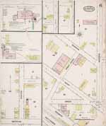
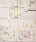
Page 6/7 Sanborn Fire Insurance Map, Durham, North Carolina, 1888 Creator(s): Sanborn (Firm), Publisher Date: 1888 Description: This fire insurance map by the Sanborn Map & Publishing Company provides a detailed look at the commercial buildings that stood within the town limits of Durham, North Carolina in 1888. The map contains an index page to city streets and the location of the county courthouse, jail, churches, manufacturers, tobacco warehouses and prizing establishments, mills, stables, and other enterprises. The map's legend provides details about the construction of the buildings (whether they have been built from stone, brick or wood) as well as details about the number of stories and windows. The map also lists the type of commercial enterprises housed in various structures. For larger businesses, the cartographer details the number of workers employed and describes the establishments’ fire-fighting capabilities. Scale ca. 1" = 50 feet. A georeferenced version of this map is also available on the Digital Durham website. Source: North Carolina Collection, Wilson Special Collections Library, University of North Carolina, Chapel Hill. Dimensions: 64 cm x 54 cm. Copyright: Reproduced with the permission of the North Carolina Collection, Wilson Special Collections Library, University of North Carolina at Chapel Hill. Library of Congress Subject Headings: Real property -- North Carolina -- Durham County -- 19th century Real property -- North Carolina -- Durham -- Maps Durham (N.C.) -- Commerce -- History -- 19th century Durham (N.C.) -- Maps -- 19th century Durham (N.C.) -- History Urban development Geographic Term: Durham, N.C. |


digitaldurham@duke.edu · About this site · Copyright © 2001 - 2006. Trudi J. Abel. All Rights Reserved.
The copyright interest in the material in this digital collection has not been transferred to the Digital Durham project. These text and images may not be used for any commercial purpose without the permission of the David M. Rubenstein Rare Book & Manuscript Library and the Digital Durham Project. Copyright permission for subsequent uses is the responsibility of the user.