Browse Collection › Maps › Map of Durham, East and West Durham, N.C.
|
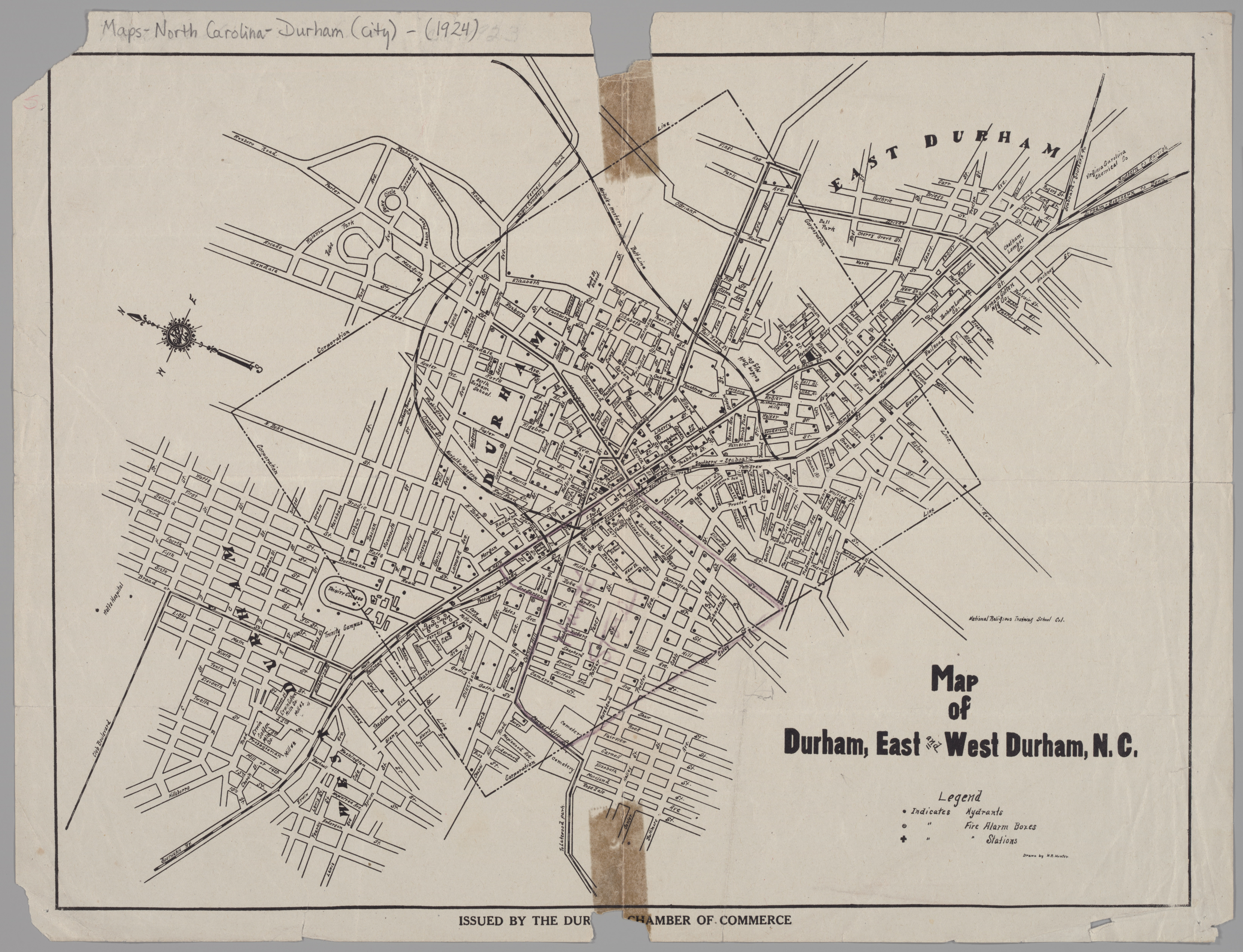
Page 1/1 Map of Durham, East and West Durham, N.C. Creator(s): Hunter, H. R., Photographer Durham Chamber of Commerce, Publisher Date: 1924 Description: A 1924 Durham Chamber of Commerce map depicting schools, mills, factories, and cemeteries in Durham. This map contains information pertaining to neighborhoods now commonly referred to as: West End, Lyon Park, West Durham (area surrounding Erwin Mills), Pearl Cotton Mills Village, Duke University (East Campus), Trinity Heights, Walltown, Trinity Park, Old North Durham, Morehead Hill, Duke Park, Downtown Durham (Central Business District), Cleveland-Holloway Street, East End, East Durham (portion), Edgemont and Morning Glory near the Golden Belt Manufacturing Company, Hayti. The map identifies street names and the location of hydrants, fire alarm boxes and fire stations. Source: Map of Durham, East and West Durham, N.C., David M. Rubenstein Rare Book & Manuscript Library, Duke University, Durham, North Carolina. Dimensions: 43.2 cm x 33 cm Library of Congress Subject Headings: Real property -- North Carolina -- Durham -- Maps Streets -- North Carolina -- Durham Durham (N.C.) -- Maps -- 20th century Durham (N.C.) -- History Historic buildings -- North Carolina -- Durham Trinity Methodist Church (Durham, N.C.) Pearl Cotton Mills (Durham, N.C.) Greater Durham Chamber of Commerce Golden Belt Manufacturing Company Geographic Term: Durham (N.C.) West Durham (N.C.) East Durham (N.C.) |
digitaldurham@duke.edu · About this site · Copyright © 2001 - 2006. Trudi J. Abel. All Rights Reserved.
The copyright interest in the material in this digital collection has not been transferred to the Digital Durham project. These text and images may not be used for any commercial purpose without the permission of the David M. Rubenstein Rare Book & Manuscript Library and the Digital Durham Project. Copyright permission for subsequent uses is the responsibility of the user.