Browse Collection › Maps › Durham, North Carolina
|
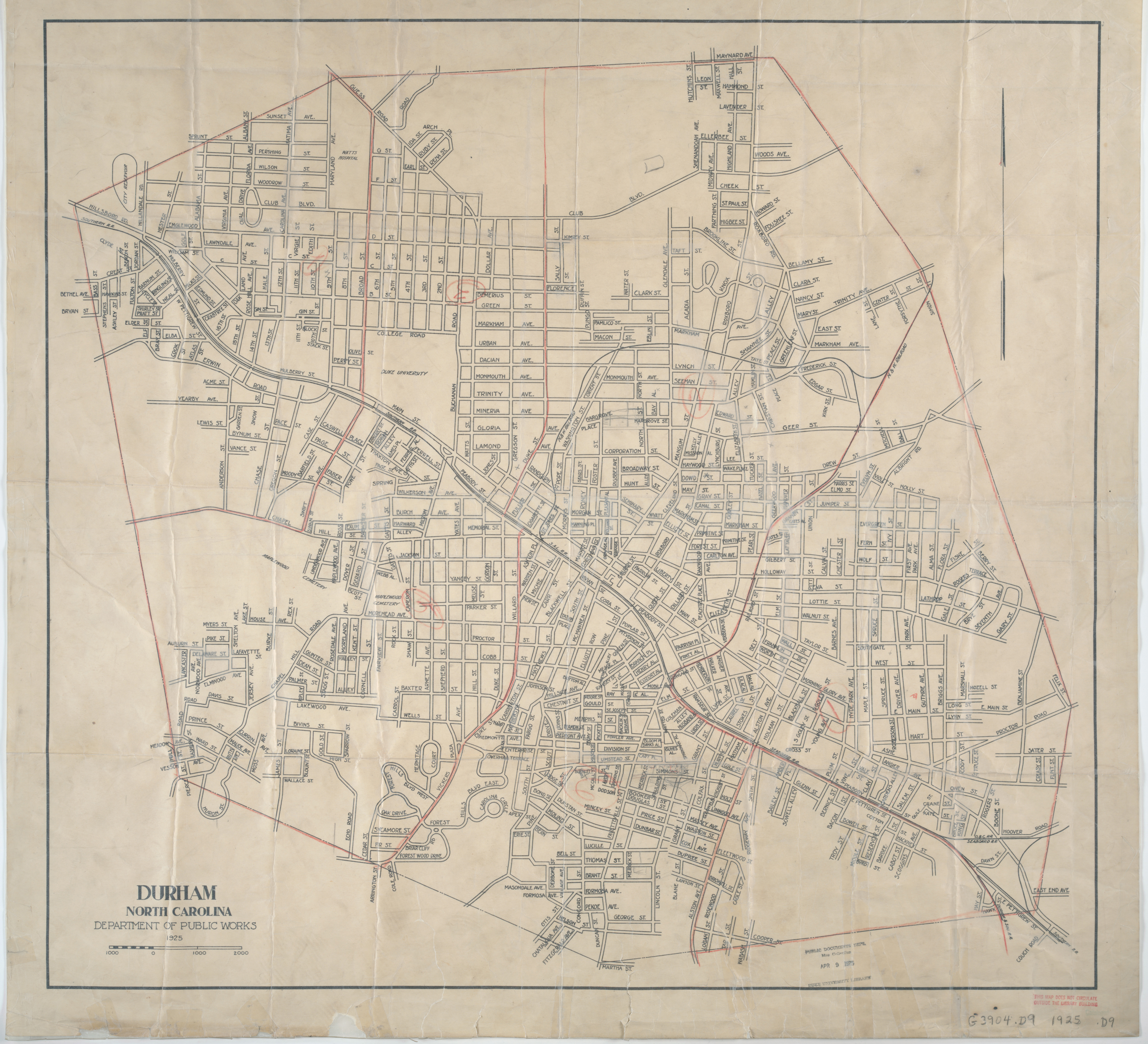
Page 1/1 Durham, North Carolina Creator(s): Durham (N.C.). Dept. of Public Works., Author Date: 1925 Description: This 1925 Durham, North Carolina map produced by the Department of Public Works provides information on streets and the layout of railroad lines in the city of Durham. The map contains annotations in red pencil. Scale [ca. 1:9,500]. Source: Government Documents, Perkins Library, Duke University Dimensions: 69 x 75 cm. Library of Congress Subject Headings: Durham (N.C.) -- Maps -- 20th century Streets -- North Carolina -- Durham Durham (N.C.) -- History Geographic Term: Durham (N.C.) |
digitaldurham@duke.edu · About this site · Copyright © 2001 - 2006. Trudi J. Abel. All Rights Reserved.
The copyright interest in the material in this digital collection has not been transferred to the Digital Durham project. These text and images may not be used for any commercial purpose without the permission of the David M. Rubenstein Rare Book & Manuscript Library and the Digital Durham Project. Copyright permission for subsequent uses is the responsibility of the user.