Browse Collection › Maps › Gray's new map of Durham, 1881
|
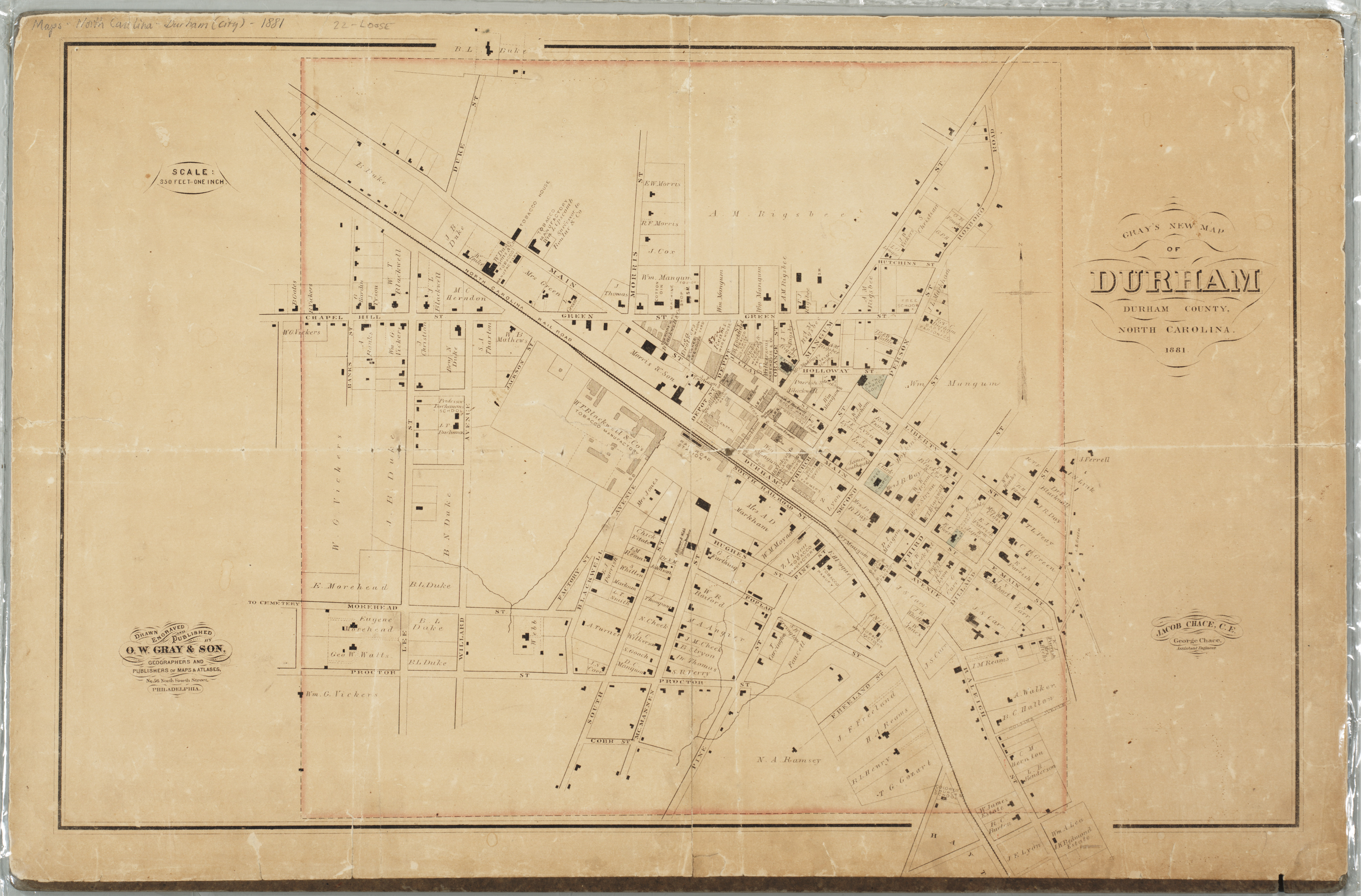
Page 1/1 Gray's new map of Durham, 1881 Creator(s): Chace, Jacob, Author Chace, George, Author O.W. Gray & Son, Publisher Date: 18810000 Description: This cadastral map from 1881 depicts buildings, street names, businesses, property owners, and railroads in Durham, North Carolina. Scale 350 feet = 1 inch or [ca. 1:4,200]. Source: Gray's new map of Durham, 1881, David M. Rubenstein Rare Book & Manuscript Library, Duke University, Durham, North Carolina. Dimensions: 43 x 62 cm Library of Congress Subject Headings: Real property -- North Carolina -- Durham -- Maps Durham (N.C.) -- Maps -- 19th century Railroads -- North Carolina -- 19th century Business enterprises -- North Carolina -- Durham County Durham (N.C.) -- History Historic buildings -- North Carolina -- Durham Real estate development -- North Carolina -- Durham County Geographic Term: Durham (N.C.) |
digitaldurham@duke.edu · About this site · Copyright © 2001 - 2006. Trudi J. Abel. All Rights Reserved.
The copyright interest in the material in this digital collection has not been transferred to the Digital Durham project. These text and images may not be used for any commercial purpose without the permission of the David M. Rubenstein Rare Book & Manuscript Library and the Digital Durham Project. Copyright permission for subsequent uses is the responsibility of the user.