Browse Collection › Maps › Map of Durham, N.C. showing sewer system
|
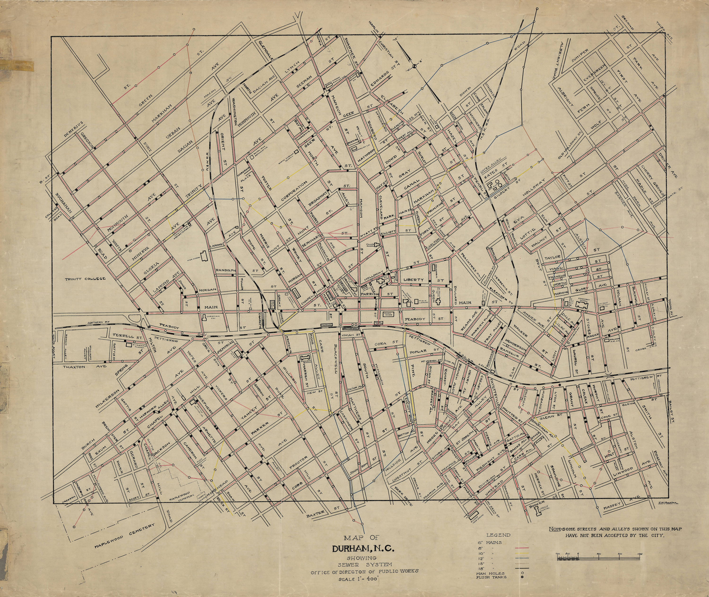
Page 1/1 Map of Durham, N.C. showing sewer system Creator(s): Thaxton, T.N., Cartographer Office of Director of Public Works, Publisher Date: 1925 (circa) Description: T.N. Thaxton penned this map of the city of Durham, North Carolina sometime in the 1920s. It provides information about street names as well as the diameter and location of sewer lines in the early 1920s. Also includes names and locations of churches and schools, railroad lines, hospitals, and cemeteries. Scale: 1” = 400 feet or [1:4,800]. Source: Durham, (N.C.). Department of Public Works. Library of Congress Subject Headings: Durham (N.C.) -- Maps -- 20th century Durham (N.C.) -- History Streets -- North Carolina -- Durham Geographic Term: Durham (N.C.) |
digitaldurham@duke.edu · About this site · Copyright © 2001 - 2006. Trudi J. Abel. All Rights Reserved.
The copyright interest in the material in this digital collection has not been transferred to the Digital Durham project. These text and images may not be used for any commercial purpose without the permission of the David M. Rubenstein Rare Book & Manuscript Library and the Digital Durham Project. Copyright permission for subsequent uses is the responsibility of the user.