Browse Collection › Maps › City of Durham, North Carolina / Powell Bill Map F.Y. 1998-1999
|
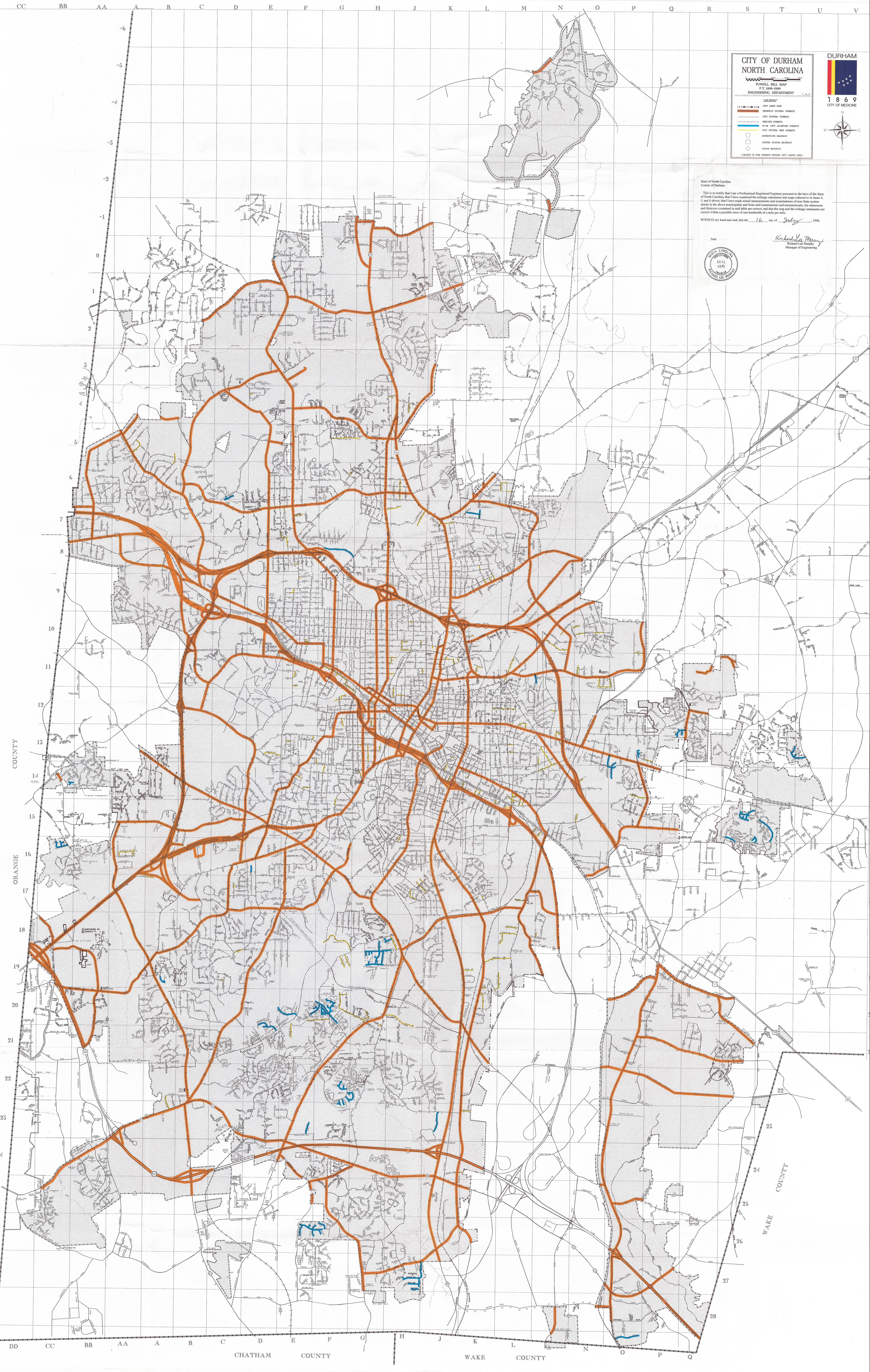
Page 1/1 City of Durham, North Carolina / Powell Bill Map F.Y. 1998-1999 Creator(s): Durham (N.C.). Engineering Department., Publisher Date: 1999 Description: The City of Durham produced this 1999 map in an effort to comply with the Powell Bill. This map demarcates the city line and identifies city system streets, private streets, 1997-1998 “city accepted streets,” dirt streets, interstate highways, United States highways, and state highway roads. City officials submitted this map to the North Carolina Department of Transportation in order to obtain funds for the maintenance of local roads under the "Powell Bill." The map contains an affidavit by engineer Richard Lee Murphy attesting to the validity of the data. Source: Durham (N.C.). Dept. of Public Works. Library of Congress Subject Headings: Durham (N.C.) -- Maps -- 20th century Streets -- North Carolina -- Durham Durham (N.C.) -- History Geographic Term: Durham (N.C.) |
digitaldurham@duke.edu · About this site · Copyright © 2001 - 2006. Trudi J. Abel. All Rights Reserved.
The copyright interest in the material in this digital collection has not been transferred to the Digital Durham project. These text and images may not be used for any commercial purpose without the permission of the David M. Rubenstein Rare Book & Manuscript Library and the Digital Durham Project. Copyright permission for subsequent uses is the responsibility of the user.