Browse Collection › Maps › Map of West Durham, N.C.
|
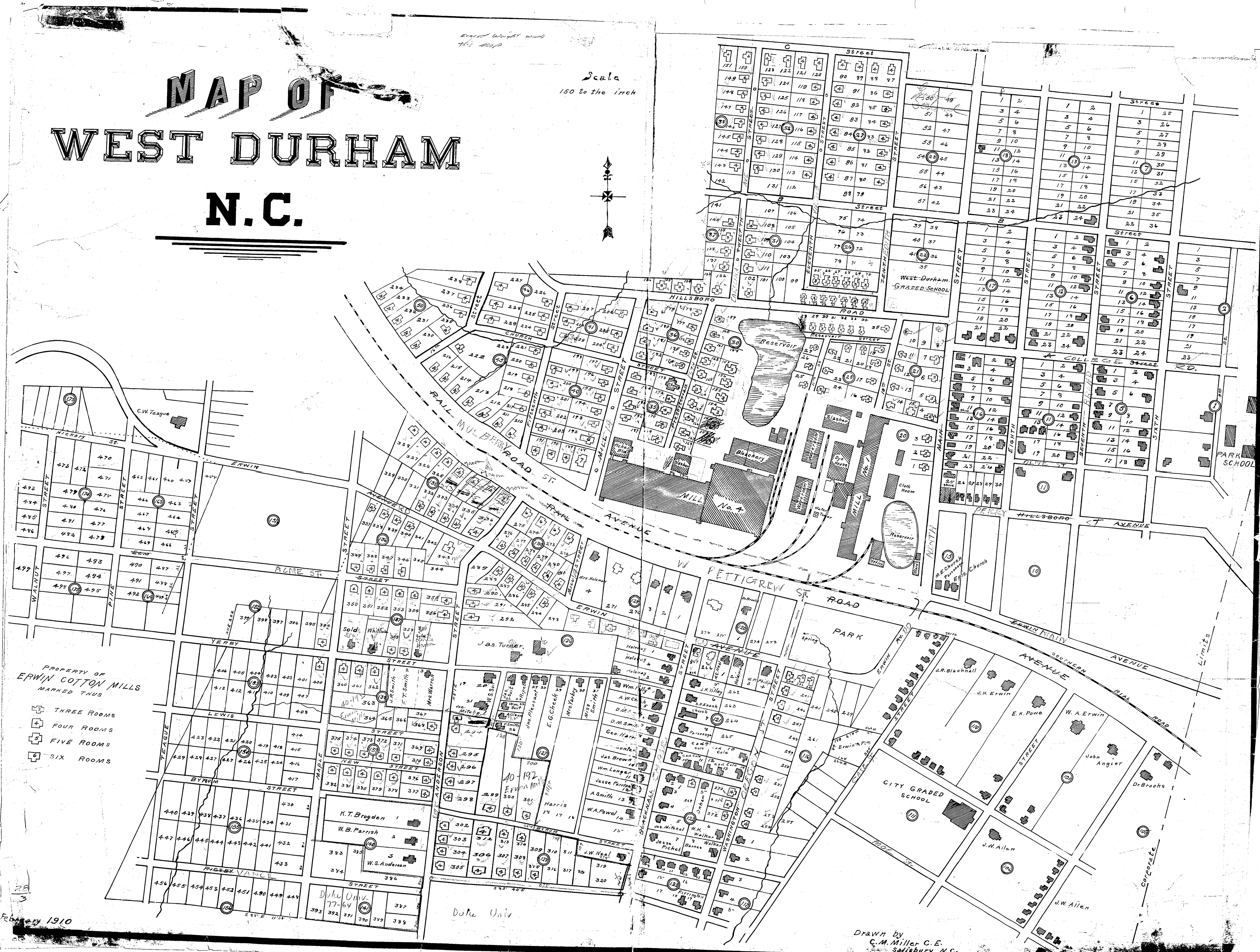
Page 1/1 Map of West Durham, N.C. Creator(s): Miller, C.M., Civil Engineer Date: 1910 Description: Civil engineer C.M. Miller drew this detailed map of West Durham, North Carolina in 1910. He identifies street names for an area which is today largely associated with the Old West Durham neighborhood, Erwin Road and Duke's Central campus. The map identifies structures at the Erwin Mills and the size of homes owned by the textile company. It also indicates the location of churches and schools and identifies the names of some property owners. Scale 150 feet to the inch or [ca. 1:1800]. Source: Durham, (N.C.). Department of Public Works. Library of Congress Subject Headings: Durham (N.C.) -- Maps -- 20th century Streets -- North Carolina -- Durham Real property -- North Carolina -- Durham -- Maps Durham (N.C.) -- History Geographic Term: Durham ( N.C.) |
digitaldurham@duke.edu · About this site · Copyright © 2001 - 2006. Trudi J. Abel. All Rights Reserved.
The copyright interest in the material in this digital collection has not been transferred to the Digital Durham project. These text and images may not be used for any commercial purpose without the permission of the David M. Rubenstein Rare Book & Manuscript Library and the Digital Durham Project. Copyright permission for subsequent uses is the responsibility of the user.