Browse Collection › Maps › Durham, North Carolina
|
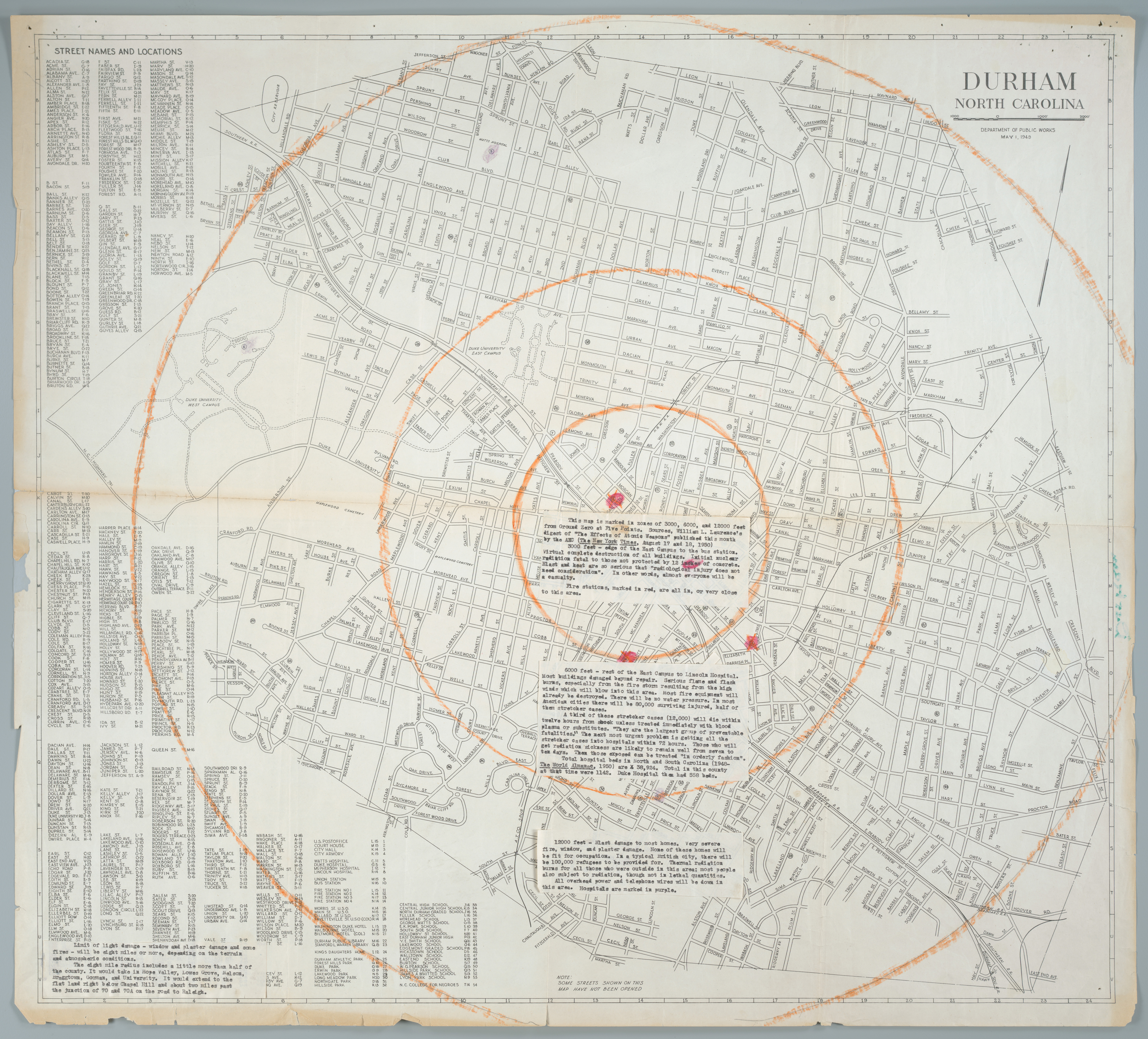
Page 1/1 Durham, North Carolina Creator(s): Durham (N.C.). Dept. of Public Works., Author Date: 1948 Description: This street map of Durham, North Carolina was published in 1948. Two years later, an unknown annotator used the map to illustrate the effect an atomic bomb blast would have on the city of Durham. The map contains several typewritten notes which predict the potential damage to buildings and the populations. Source: Government Documents, Perkins Library, Duke University Library of Congress Subject Headings: Durham (N.C.) -- History Durham (N.C.) -- Maps -- 20th century Geographic Term: Durham (N.C.) |

digitaldurham@duke.edu · About this site · Copyright © 2001 - 2006. Trudi J. Abel. All Rights Reserved.
The copyright interest in the material in this digital collection has not been transferred to the Digital Durham project. These text and images may not be used for any commercial purpose without the permission of the David M. Rubenstein Rare Book & Manuscript Library and the Digital Durham Project. Copyright permission for subsequent uses is the responsibility of the user.