Browse Collection › Maps › Occupancy map, business section Durham, North Carolina
|
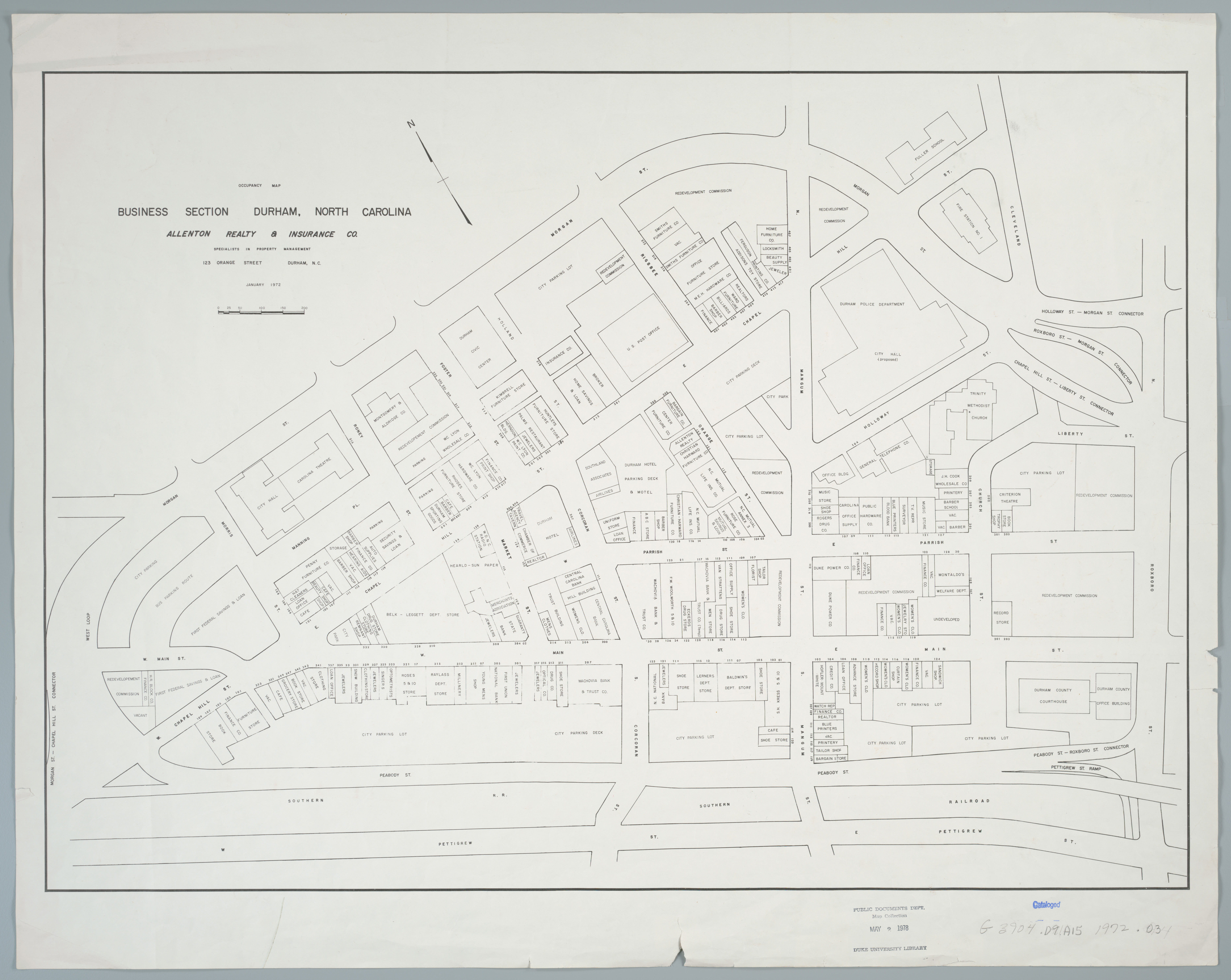
Page 1/1 Occupancy map, business section Durham, North Carolina Creator(s): Allenton Realty & Insurance Co., Author Date: 1972 Description: This 1972 map created by the Allenton Realty and Insurance Company identifies the types of businesses that occupied commercial space in the central business district of Durham, North Carolina. Th map highlights a geographic area that includes "Five Points" and is bounded by Peabody Street, Roxboro Road, Morgan Street and the "West Loop." Scale [ca. 1:1,150] Source: Government Documents, Perkins Library, Duke University Dimensions: 50 x 70 cm. Copyright: Reprinted with the permission of Jim Anthony, SIOR, Anthony & Co. ONCOR International, Raleigh, North Carolina. Library of Congress Subject Headings: Durham (N.C.) -- Maps -- 20th century Real estate business -- North Carolina -- Durham Real property -- North Carolina -- Durham -- Maps Geographic Term: Durham (N.C.) |
digitaldurham@duke.edu · About this site · Copyright © 2001 - 2006. Trudi J. Abel. All Rights Reserved.
The copyright interest in the material in this digital collection has not been transferred to the Digital Durham project. These text and images may not be used for any commercial purpose without the permission of the David M. Rubenstein Rare Book & Manuscript Library and the Digital Durham Project. Copyright permission for subsequent uses is the responsibility of the user.