Browse Collection › Maps › County of Durham/ North Carolina/ Base Map/ May 1948
|
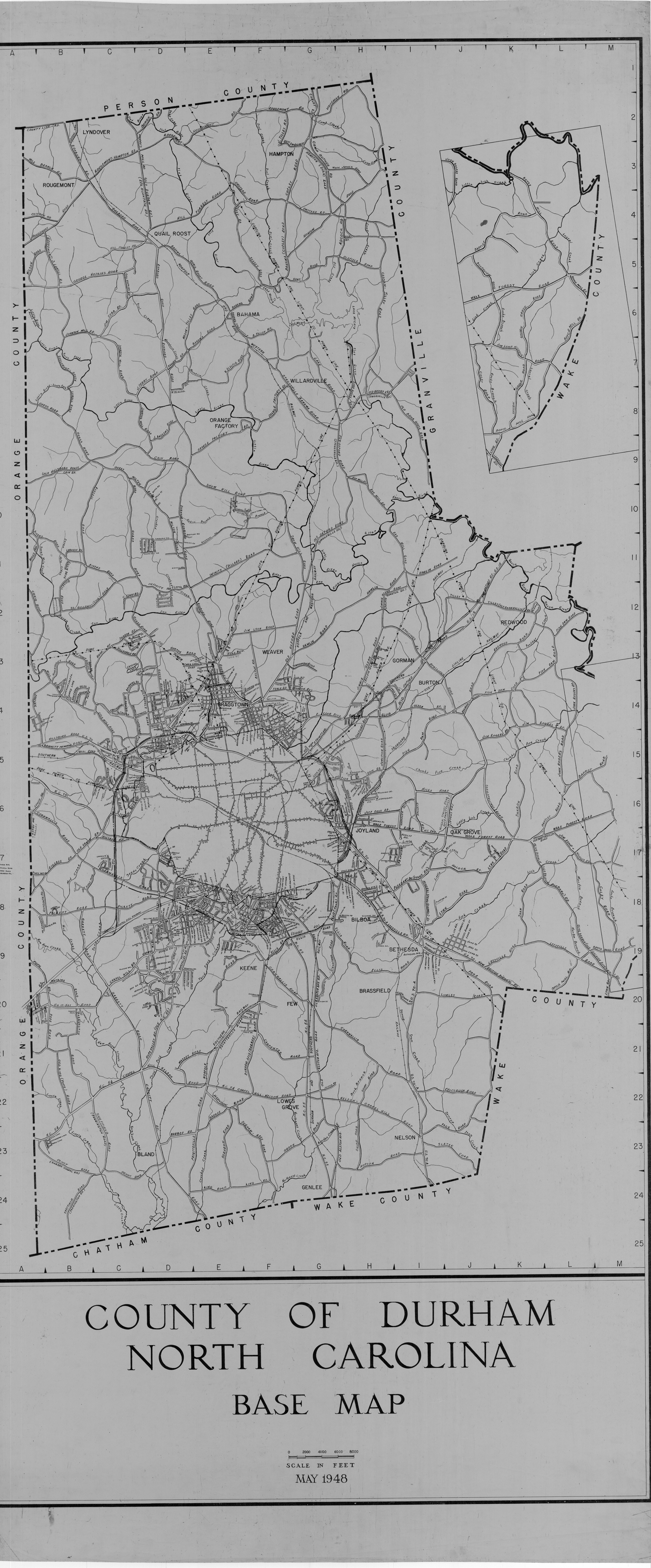
Page 1/1 County of Durham/ North Carolina/ Base Map/ May 1948 Date: 1948 Description: This 1948 base map of the County of Durham, North Carolina lists state highways and major roads as well as creeks, rivers, railroad lines and power lines. Scale 1" = 2000 feet. Source: Durham (N.C.). Dept. of Public Works. Library of Congress Subject Headings: Durham County (N.C.) -- Maps -- 20th century Durham County (N.C.) -- History Durham County (N.C.) -- History -- Maps Geographic Term: Durham County (N.C.) |
digitaldurham@duke.edu · About this site · Copyright © 2001 - 2006. Trudi J. Abel. All Rights Reserved.
The copyright interest in the material in this digital collection has not been transferred to the Digital Durham project. These text and images may not be used for any commercial purpose without the permission of the David M. Rubenstein Rare Book & Manuscript Library and the Digital Durham Project. Copyright permission for subsequent uses is the responsibility of the user.